


-
Free Shipping
Anywhere in the US
-
Questions? Email Us
-
Secure Checkout
Buy with Confidence
-
Easy Returns
No hassle guaranteed
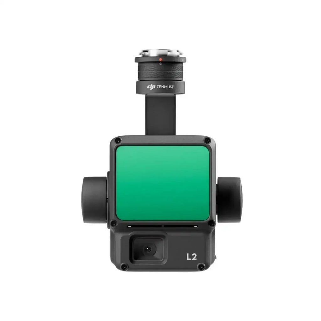
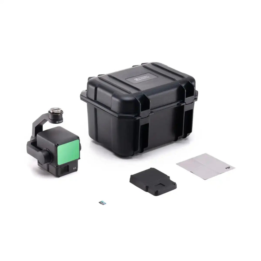
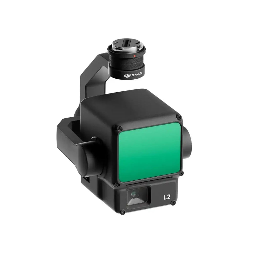
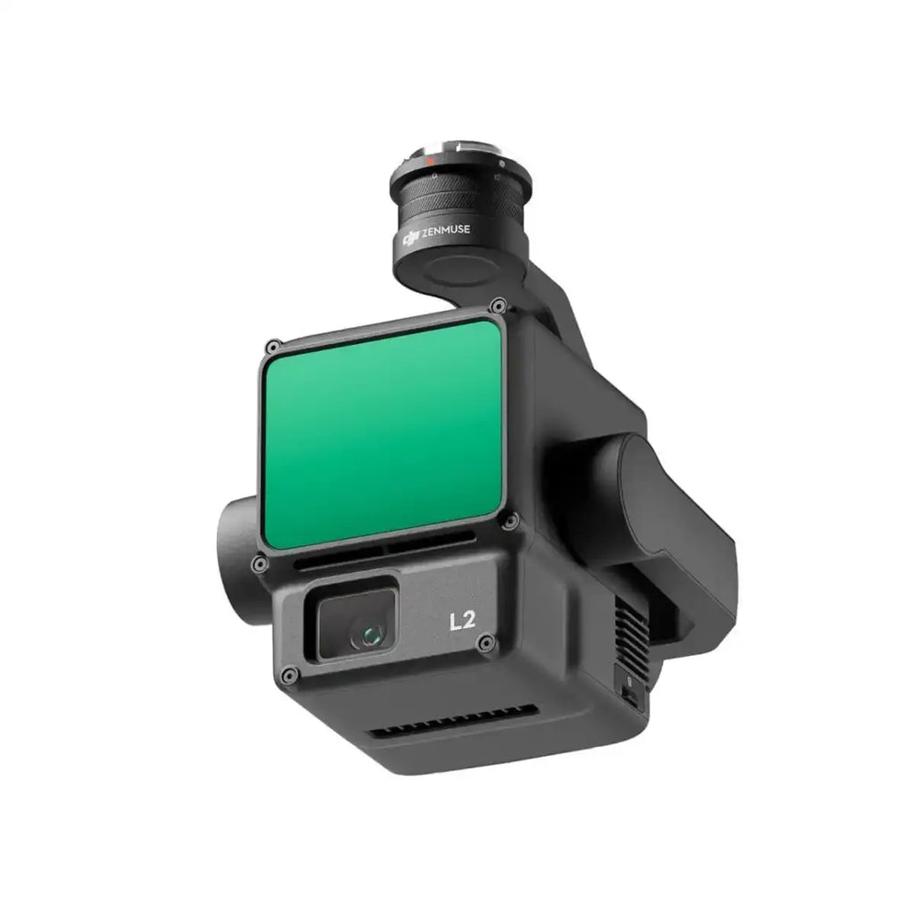
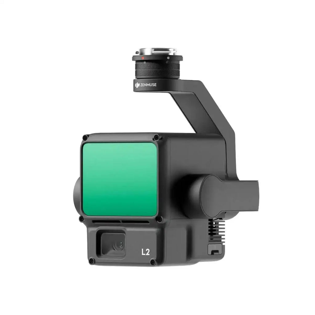
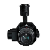
DJI Zenmuse L2 LiDAR Camera with Care Enterprise Basic
Description
- 4-cm vertical accuracy
- 5-cm horizontal accuracy
- Collects data from a 2.5km² area in 1 flight
- 250m/450m Detection range
- 5 Returns
- Turnkey solution
- Point Cloud LiveView
- One-click processing on DJI Terra
- Includes DJI Care Enterprise Basic with up to 2 paid replacements offered within 1 year after product is activated

The DJI Zenmuse L2 is an advanced LiDAR system, building upon the success of its predecessor, the Zenmuse L1. It offers improved features, including an enhanced RGB camera, upgraded LiDAR module, and enhanced accuracy, making it a valuable tool for professionals.
Increased hardware power and efficiency
The Zenmuse L2 leverages aerial LiDAR technology to provide efficient and precise 3D data acquisition for professionals in various fields, such as land surveying, mapping, electricity inspection, forestry, and infrastructure management.
It significantly reduces workload and field measurement time while improving detection efficiency.
Perfect for DJI Matrice 300/350 RTK
The Zenmuse L2 incorporates a high-accuracy IMU system and integrates seamlessly with DJI Matrice 300 RTK and Matrice 350 RTK drones.
This combination delivers accurate and efficient data collection while enhancing in-the-field experiences with immediate readiness and high precision.
Improved detection range and safety
With a 30% increase in detection range compared to its predecessor, the Zenmuse L2 enhances operational safety and efficiency. It detects objects from greater distances, has a reduced spot size for more detailed data, and supports multiple return modes for enhanced data acquisition.
Enhanced imaging and reduced operational costs
The Zenmuse L2 features an upgraded RGB mapping camera with improved imaging and colorized point cloud details.
It offers reduced photo intervals, extended shutter life, and the ability to capture photos and videos, even when point cloud data isn't necessary.
Software for control and data processing
DJI Pilot 2 software offers various display modes and real-time monitoring options, enhancing control during operation. It provides access to distance information and supports real-time point cloud coloring.
Additionally, it can generate route operation quality reports and offers point cloud processing.
One tool, multiple use cases
The Zenmuse L2, in combination with DJI Matrice 300 RTK or Matrice 350 RTK drones and DJI Terra software, is suitable for various industries. It excels in applications such as topographic mapping, forestry, and electricity inspection, offering efficient data collection and analysis for diverse scenarios.
More protection with DJI Care Enterprise
This DJI Zenmuse L2 Lidar Camera with Care Enterprise Basic package comes with 1-year coverage of DJI Care Enterprise Basic Plan.
The plan includes water damage coverage, 2 low-cost replacements, DJI Care Express, and free two-way shipping.
Specifications
General
-
Product Name
Zenmuse L2
-
Dimensions
155×128×176 mm (L×W×H)
-
Weight
905±5 g
-
Power
28 W (typical)
58 W (max.)
-
IP Rating
IP54
-
Supported Aircraft
Matrice 300 RTK (requires DJI RC Plus)
Matrice 350 RTK
-
Storage Temperature
-20° to 60° C (-4° to 140° F)
System Performance
-
Detection Range
450m @50% reflectivity, 0 klx
250m @10% reflectivity, 100 klx
Typical data. Measured using a flat subject with a size larger than the laser beam diameter, perpendicular angle of incidence, and an atmospheric visibility of 23 km. In low-light environments, the laser beams can achieve the optimal detection range. If a laser beam hits more than one subject, the total laser transmitter power is split, and the achievable range is reduced. The maximum detection range is 500 m.
-
Point Cloud Rate
Single return: max. 240,000 pts/s
Multiple returns: max. 1,200,000 pts/s
-
System Accuracy
Horizontal: 5 cm @ 150 m
Vertical: 4 cm @ 150 m
Measured under the following conditions in a DJI laboratory environment: Zenmuse L2 mounted on a Matrice 350 RTK and powered up. Using DJI Pilot 2’s Area Route to plan the flight route (with Calibrate IMU enabled). Using repetitive scanning with the RTK in the FIX status. The relative altitude was set to 150 m, flight speed to 15 m/s, gimbal pitch to -90°, and each straight segment of the flight route was less than 1500 m. The field contained objects with obvious angular features, and used exposed hard ground check points that conformed to the diffuse reflection model. DJI Terra was used for post-processing with Optimize Point Cloud Accuracy enabled. Under the same conditions with Optimize Point Cloud Accuracy not enabled, the vertical accuracy is 4 cm and the horizontal accuracy is 8 cm.
-
Real-Time Point Cloud Coloring Coding
Reflectivity, Height, Distance, RGB
LiDAR
-
Ranging Accuracy (RMS 1σ)
2 cm @ 150 m
Measured in an environment of 25° C (77° F) with a subject of 80% reflectivity at a distance of 150 m. The actual environment may differ from the testing environment. The figure listed is for reference only.
-
Maximum Returns Supported
5
-
Scanning Modes
Non-repetitive scanning pattern, Repetitive scanning pattern
-
FOV
Repetitive scanning pattern: Horizontal 70°, Vertical 3°
Non-repetitive scanning pattern: Horizontal 70°, Vertical 75°
-
Minimum Detection Range
3 m
-
Laser Beam Divergence
Horizontal 0.2 mrad, Vertical 0.6 mrad
Measured at full width at half maximum (FWHM) conditions. 0.6 mrad signifies that for every 100m increase in distance, the diameter of the laser beam expands by 6 cm.
-
Laser Wavelength
905 nm
-
Laser Spot Size
Horizontal 4 cm, vertical 12 cm @ 100 m (FWHM)
-
Laser Pulse Emission Frequency
240 kHz
-
Laser Safety
Class 1 (IEC 60825-1:2014)
-
Accessible Emission Limit (AEL)
233.59 nJ
-
Reference Aperture
Effective Aperture: 23.85 mm (equivalent to circular)
-
Max Laser Pulse Emission Power Within 5 Nanoseconds
46.718 W
Inertial Navigation System
-
IMU Update Frequency
200 Hz
-
Accelerometer Range
±6 g
-
Angular Velocity Meter Range
±300 dps
-
Yaw Accuracy (RMS 1σ)
Real-time: 0.2°, Post-processing: 0.05°
Measured under the following conditions in a DJI laboratory environment: Zenmuse L2 mounted on a Matrice 350 RTK and powered up. Using DJI Pilot 2’s Area Route to plan the flight route (with Calibrate IMU enabled). RTK in the FIX status. The relative altitude was set to 150 m, flight speed to 15 m/s, gimbal pitch to -90°, and each straight segment of the flight route was less than 1500 m.
-
Pitch/Roll Accuracy (RMS 1σ)
-
Real-time: 0.05°, Post-processing: 0.025°
Measured under the following conditions in a DJI laboratory environment: Zenmuse L2 mounted on a Matrice 350 RTK and powered up. Using DJI Pilot 2’s Area Route to plan the flight route (with Calibrate IMU enabled). RTK in the FIX status. The relative altitude was set to 150 m, flight speed to 15 m/s, gimbal pitch to -90°, and each straight segment of the flight route was less than 1500 m.
-
Horizontal Positioning Accuracy
RTK FIX: 1 cm + 1 ppm
-
Vertical Positioning Accuracy
RTK FIX: 1.5 cm + 1 ppm
RGB Mapping Camera
-
Sensor
4/3 CMOS, Effective Pixels: 20 MP
-
Lens
FOV: 84°
Format Equivalent: 24 mm
Aperture: f/2.8-f/11
Focus Points: 1 m to ∞ (with autofocus)
-
Shutter Speed
Mechanical Shutter: 2-1/2000 s
Electronic Shutter: 2-1/8000 s
-
Shutter Count
200000
-
Photo Size
5280×3956 (4:3)
-
Still Photography Modes
Single shot: 20 MP
Timed: 20 MP
JPEG Timed Interval: 0.7/1/2/3/5/7/10/15/20/30/60 s
RAW/JPEG + RAW Timed Interval: 2/3/5/7/10/15/20/30/60 s
-
Video Codec and Resolution
H.264
4K: 3840×2160@30fps
FHD: 1920×1080 @30fps
-
ISO
Video: 100-6400
Photo: 100-6400
-
Video Bitrate
4K: 85Mbps
FHD: 30 Mbps
-
Supported File System
exFAT
-
Photo Format
JPEG/DNG (RAW)
-
Video Format
MP4 (MPEG-4 AVC/H.264)
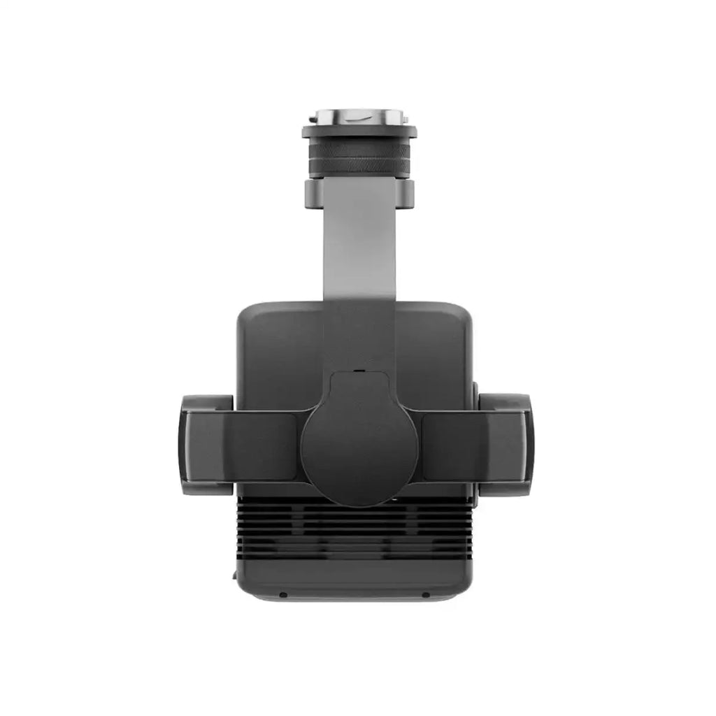
Gimbal
-
Stabilization System
3-axis (tilt, roll, pan)
-
Angular Vibration Range
0.01°
-
Mounting
Detachable DJI SKYPORT
-
Mechanical Range
Tilt: -143° to +43°
Pan: ±105°
* Structural limit, not controllable range.
-
Controllable Range
Tilt: -120° to +30°
Pan: ±90°
-
Operation Mode
Follow/Free/Re-center
Data Storage
-
Raw Data Storage
Photo/IMU/Point cloud/GNSS/Calibration files
-
Point Cloud Data Storage
Real-time modeling data storage
-
Supported microSD Cards
microSD: Sequential writing speed 50 MB/s or above and UHS-I Speed Grade 3 rating or above; Max capacity: 256 GB. Use the recommended microSD cards.
-
Recommended microSD Cards
Lexar 1066x 64GB U3 A2 V30 microSDXC
Lexar 1066x 128GB U3 A2 V30 microSDXC
Kingston Canvas Go! Plus 128GB U3 A2 V30 microSDXC
Lexar 1066x 256GB U3 A2 V30 microSDXC
Post-Processing
-
Supported Software
DJI Terra
-
Data Format
DJI Terra supports exporting point cloud models in the following formats:
PNTS/LAS/PLY/PCD/S3MB
In The Box
- 1x DJI Zenmuse L2
- 1x MicroSD Card (128GB)
- 1x Lens Cap
- 1x Storage Case
- 1x Lens Cleaning Cloth
- DJI Care Enterprise Basic
Shipping
Fast, Secure Delivery We ship high-utility survival and tactical gear—including solar generators, satellite phones, and surveillance systems—within 5–8 business days for most orders. For bulk, oversized, or custom-configured products, delivery may take 8–12 business days, depending on stock availability and destination. Estimated shipping timelines will be shown at checkout. Order Tracking & Support Once your gear is on the move, you'll receive a tracking number via email to follow your shipment in real time. We ship across the U.S. and accommodate international deliveries upon request. Need help? Our support team is always ready to assist with tracking, delays, or shipping questions.
Returns Policy
30-Day Return Window We accept returns within 30 days of delivery for items that are unused, in original packaging, and in resalable condition. Proof of purchase is required. Please ensure all gear is carefully packed to avoid damage in transit. Return Shipping Customers are responsible for return shipping costs. A 15–25% restocking fee may apply depending on the product type. Note: Tactical electronics, emergency communication devices, and survival systems (e.g. satellite phones, surveillance gear, drones) may be marked final sale once used or opened. Start Your Return To initiate a return, email us at support@outlandsecure.com with your order number and the reason for return. We’ll walk you through the next steps to ensure a smooth return process.
We offer high-utility survival and tactical gear including solar generators, outdoor surveillance systems, satellite phones, HF radios, drones, and emergency shelters—ideal for preppers, off-grid living, and mission-critical applications.
Absolutely. Every product is selected with self-reliance in mind. Whether you're planning for long-term survival, emergency prep, or remote travel, our gear supports independent operation without relying on public infrastructure.
Most products are plug-and-play or include setup instructions. However, for items like surveillance systems or communication devices, we recommend professional installation for optimal performance.
Our solar-powered generators are safe for indoor use as they produce zero emissions. Always follow product guidelines, especially for battery storage and ventilation.
Yes. Our rugged satellite phones offer global coverage through satellite networks, making them reliable in remote locations, across borders, and in natural disasters.
We do. Contact us for custom quotes on bulk purchases for government contracts, agencies, or group survival preparedness. We support procurement needs across various sectors.
Yes. Once your order is shipped, you’ll receive a tracking number via email. For any shipping or delivery concerns, our support team is ready to help.